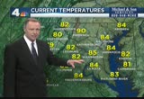
stretches from along the atlantic seaboard all the way back into the tennessee valley and into northeast texas, but this front is showing some signs that it is going to be gradually drifting south and, as it does, that will decrease our chance for any storms around. but we're still close enough to it that later today we could get some already getting some showers popping up nearro roano and that's heading towards richmond but well to our south and an isolated chance around the melt row area and these areas in green and potential thunderstorms and early evening. after that, though, we'll settle down and by dawn tomorrow, another cool start. many areas in the 60s and looks like we'll be in the 60s again, tomorrow morning throughout much of the region. for the rest of the afternoon, just a few of the clouds in and out and slight chance of an isolated storm in and out and then dropping back to the upper 80s to perhaps low 80s by mid to late afternoon and then by early evening, mid-80s. by sunset, we'll be down to near 80 degrees and midnight near 70 with a partly sunny sky and during the day tomor
 Live Music Archive
 Librivox Free Audio
 Metropolitan Museum
 Cleveland Museum of Art
 Internet Arcade
 Console Living Room
 Books to Borrow
 Open Library
 TV News
 Understanding 9/11